In Tanzania, extreme climate events frequently result in economic losses that exceed 1% of GDP and threaten the majority of Tanzanian’s livelihoods because of their high dependence on natural resources.
Adaptation priorities, as identified in the country’s 2015 Nationally Determined Contribution, focused on agriculture and water resource management; coastal protection; alternative clean energy sources; sustainable tourism activities; and community awareness programs in public health.
But rapid urbanization is shifting the disaster risk profile in Tanzania, as it is across Sub Saharan Africa, with urban settlements increasingly vulnerable to floods, cyclones and earthquakes.
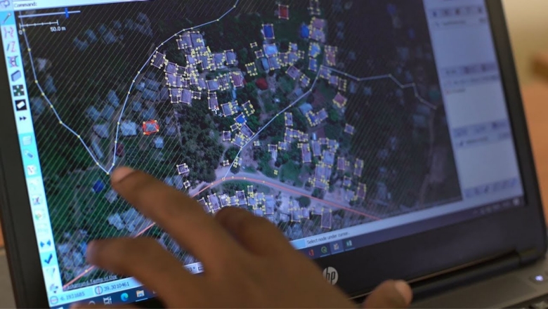
Low-cost digital tools are helping bridge an important data gap as towns and cities continue to grow in unplanned, unsurveyed manners. In Dar es Salaam, for example, where informal settlements along the banks of the Msimbazi River are vulnerable to flooding during the rainy season, citizen scientists and drones were mobilized to help improve the accuracy of soil maps to better guide urban decision-making.
Using this approach, the Tanzania Urban Resilience Program, a UK AID-funded initiative jointly implemented by the World Bank and the Government of Tanzania, was able to conduct flood modelling for the city at a fraction of the cost and with greater accuracy than traditional surveys.
The program has also created an innovative Resilience Academy, where students learn practical digital skills while working to make their countries safer from climate change. Using drones and household surveys, students mapped the whole island of Zanzibar for example: by digitizing 500,000 buildings, their work increased the previous building register of only 163,000 dwellings.
This participatory approach was expanded in 2020 to tackle the challenge of mapping urban trees. At a time when the pandemic left many people unemployed, 50 young people – most of them between the ages of 19 and 25, were paid to locate trees via a cellphone app.
Since tree roots retain soils and tree canopies retain water and reduce flash floods, the proportion of urban tree cover in the river basin is a critical part of any flood-abating plan. The labor-intensive but simple task was well suited to micro-tasking, a type of work where big projects are broken down into small digital actions.
A similar pilot was also conducted in Freetown, Sierra Leone, with positive results pointing to larger and possibly more rewarding and increasingly skillful employment possibilities in the future.


No comments:
Post a Comment